 |
||||||||||||||||||||||||||||||||||||||||||||||||||||||||||||||||||||||||||||||||||||||||||||||||||||||||||||||||||||||||||||||||||||||||||||||||||||||||||||||||||||||||||||||||||||||||||||||||||||||||||||||||||||||||||||||||||||||||||||||||||||||||||||||||||||||||||||||||||||||||||||||||||||||||||||||||||||||||||||||||||||||||||||||||||||||||||||||||||||||||||||||||||||||||||||||||||||||||||||||||||||||||||||||||||||||||||
|
||||||||||||||||||||||||||||||||||||||||||||||||||||||||||||||||||||||||||||||||||||||||||||||||||||||||||||||||||||||||||||||||||||||||||||||||||||||||||||||||||||||||||||||||||||||||||||||||||||||||||||||||||||||||||||||||||||||||||||||||||||||||||||||||||||||||||||||||||||||||||||||||||||||||||||||||||||||||||||||||||||||||||||||||||||||||||||||||||||||||||||||||||||||||||||||||||||||||||||||||||||||||||||||||||||||||||
Bartlett Eaves |
||||||||||||||||||||||||||||||||||||||||||||||||||||||||||||||||||||||||||||||||||||||||||||||||||||||||||||||||||||||||||||||||||||||||||||||||||||||||||||||||||||||||||||||||||||||||||||||||||||||||||||||||||||||||||||||||||||||||||||||||||||||||||||||||||||||||||||||||||||||||||||||||||||||||||||||||||||||||||||||||||||||||||||||||||||||||||||||||||||||||||||||||||||||||||||||||||||||||||||||||||||||||||||||||||||||||||
|
||||||||||||||||||||||||||||||||||||||||||||||||||||||||||||||||||||||||||||||||||||||||||||||||||||||||||||||||||||||||||||||||||||||||||||||||||||||||||||||||||||||||||||||||||||||||||||||||||||||||||||||||||||||||||||||||||||||||||||||||||||||||||||||||||||||||||||||||||||||||||||||||||||||||||||||||||||||||||||||||||||||||||||||||||||||||||||||||||||||||||||||||||||||||||||||||||||||||||||||||||||||||||||||||||||||||||
 |
||||||||||||||||||||||||||||||||||||||||||||||||||||||||||||||||||||||||||||||||||||||||||||||||||||||||||||||||||||||||||||||||||||||||||||||||||||||||||||||||||||||||||||||||||||||||||||||||||||||||||||||||||||||||||||||||||||||||||||||||||||||||||||||||||||||||||||||||||||||||||||||||||||||||||||||||||||||||||||||||||||||||||||||||||||||||||||||||||||||||||||||||||||||||||||||||||||||||||||||||||||||||||||||||||||||||||
|
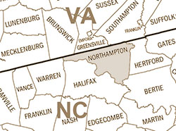
Bartlett Eaves was born about 1765 in Brunswick County, Virginia. His parents were Graves Eaves and Martha Yancy. On September 11, 1784 in the Morgan District Superior Court show that
In October, 1785 in Rutherford County, Graves Eves proved his son Bartlet Eves was under the age of 21 so he would not have to pay the poll tax. Bartlett married his neighbor, Charity Lewis, about 1785. Bartlett and Charity's children were born in Rutherford County, North Carolina. Nancy Eaves (1786, married Cornelius Autrey), They were members of the Sandy Run Baptist Church. In 1790 Bartlet Eaves appeared in Rutherford County in the 7th Company. The household consisted of 2 males over 16, 2 females and 2 males under 16. In November 1792 Bartelette Eaves bought 10 acres in Rutherford County. The land was on Robertson's Creek (of Second Broad River) and was next to Thomas Robertson's original grant of 430 acres, On August 8, 1795 James Arrowood bought
from Thomas Davis, for 60£. The deed was witnessed by Abel Lewis and Bartlett Eavis. In 1797 he sold James English the 10 acres he purchased in 1792 for 100£. The deed was witnessed by Abel Lewis and William Liversill. In 1799, he bought a 50 acres on the northeast side of Robinson's Creek from Zachariah Sullins for 75£.It was the lower part of 200 acres granted to Abel Lewis by the Rutherford County Sheriff. This deed was witnessed by A. L. Lewis, and F. Morrow. In 1800 the household was still in in the Rutherford County. The household consisted of
Graves and Bartlett were dismissed from the Sandy Run Church in November, 1804. In 1808 he sold 38 acres on Webb's Creek to Amos Wall for 10£. The deed was witnessed by John Wall and John Carter. In 1809 he bought land in Jasper County, Georgia from Thomas Robinson. In 1830 the household was in Perry County, Alabama. In 1833 he was bondsman when Barltet E. Autery and Nancy Buttler who married Marengo County, Alabama. |
|
||||||||||||||||||||||||||||||||||||||||||||||||||||||||||||||||||||||||||||||||||||||||||||||||||||||||||||||||||||||||||||||||||||||||||||||||||||||||||||||||||||||||||||||||||||||||||||||||||||||||||||||||||||||||||||||||||||||||||||||||||||||||||||||||||||||||||||||||||||||||||||||||||||||||||||||||||||||||||||||||||||||||||||||||||||||||||||||||||||||||||||||||||||||||||||||||||||||||||||||||||||||||||||||||||||||||
|
||||||||||||||||||||||||||||||||||||||||||||||||||||||||||||||||||||||||||||||||||||||||||||||||||||||||||||||||||||||||||||||||||||||||||||||||||||||||||||||||||||||||||||||||||||||||||||||||||||||||||||||||||||||||||||||||||||||||||||||||||||||||||||||||||||||||||||||||||||||||||||||||||||||||||||||||||||||||||||||||||||||||||||||||||||||||||||||||||||||||||||||||||||||||||||||||||||||||||||||||||||||||||||||||||||||||||
|
©Roberta Tuller 2025
|
||||||||||||||||||||||||||||||||||||||||||||||||||||||||||||||||||||||||||||||||||||||||||||||||||||||||||||||||||||||||||||||||||||||||||||||||||||||||||||||||||||||||||||||||||||||||||||||||||||||||||||||||||||||||||||||||||||||||||||||||||||||||||||||||||||||||||||||||||||||||||||||||||||||||||||||||||||||||||||||||||||||||||||||||||||||||||||||||||||||||||||||||||||||||||||||||||||||||||||||||||||||||||||||||||||||||||